IN MONGOLIAN
GEOGRAPHY AND CLIMATE
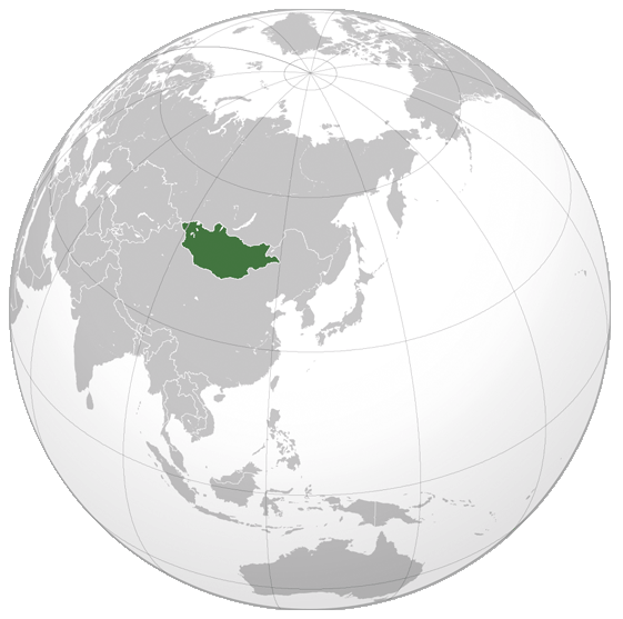
Mongolia is a landlocked country in Northern Asia, strategically located between China and Russia. The terrain is one of mountains and rolling plateaus, with a high degree of relief.
Overall, the land slopes from the high Altay Mountains of the west and the
north to plains and depressions in the east and the south. The Khuiten Peak
in extreme western Mongolia on the Chinese border is the highest
point (4,374 meters). The lowest is 518 meters, an otherwise undistinguished
spot in the eastern Mongolian plain. The country has an average elevation of
1,580 meters. The landscape includes one of Asia's largest freshwater lakes
(Lake Khuvsgul), many salt lakes, marshes, sand dunes, rolling grasslands,
alpine forests, and permanent montane glaciers. Northern and western
Mongolia are seismically active zones, with frequent earthquakes and many
hot springs and extinct volcanoes.
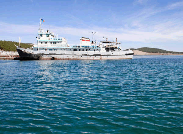
In this pictures Lake Khuvsgul
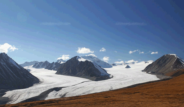
In Altay Tavan Bogd
At 1,564,116 square kilometres (603,909 sq mi), Mongolia is the 19th largest
and the most sparsely populated independent country in the world, with a
population of around 2.9 million people. It is also the world's
second-largest landlocked country after Kazakhstan. The country contains
very little arable land, as much of its area is covered by steppes, with
mountains to the north and west and the Gobi Desert to the south.
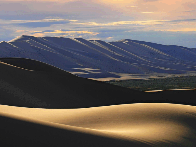
In Gobi Desert
The geography of Mongolia is varied with the Gobi Desert to the south and with cold and mountainous regions to the north and west.
Much of Mongolia consists of steppes. The highest point in Mongolia is the Khuiten Peak in the Tavan bogd massif in the far west at 4,374 m (14,350 ft). The basin of the lake Uvs nuur, shared with Tuva Republic in Russia, is a natural World Heritage Site. Most of the country is hot in the summer and extremely cold in the winter, with January averages dropping as low as -30 °C (-22 °F).
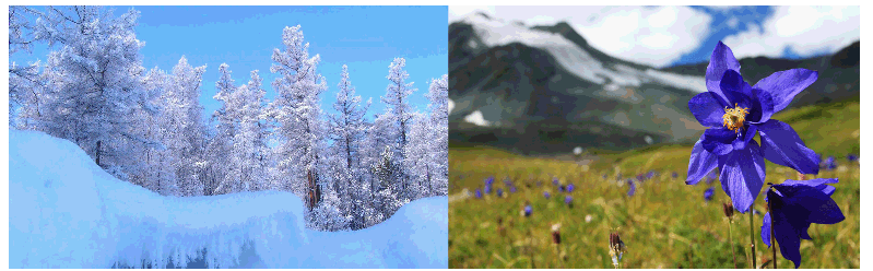
In winter In spring